11
Cultural
heritage
This section presents the Cultural Heritage Impact Assessment (CHIA) which
comprises Archaeological Impact Assessment (AIA) and Built Heritage Impact
Assessment (BHIA).
11.2
Statutory Requirements and Evaluation Criteria
The following legislations and guidelines are
applicable to the assessment of impacts on sites of cultural heritage in
·
Environmental Impact Assessment Ordinance (EIAO) (Cap. 499.S16), Technical
Memorandum on the EIA Process (EIAO-TM), Annexes 10 and 19 and Guidance Notes
on Assessment of Impact on Sites of Cultural Heritage in EIA Studies;
·
Antiquities and Monuments Ordinance (AM Ordinance) (Cap. 53);
·
Guidelines for Cultural Heritage Impact
Assessment;
·
·
Land (Miscellaneous
Provisions) Ordinance (Cap.
28).
11.2.1
EIAO
and EIAO-TM
According to the EIAO, Schedule 1
Interpretation, “Sites of Cultural Heritage” are defined as “an antiquity or
monument, whether being a place, building, site or structure or a relic, as
defined in the AM Ordinance and any
place, building, site, or structure or a relic identified by the Antiquities
and Monuments Office (AMO) to be of archaeological, historical or palaeontological significance”.
The technical scope for evaluating and assessing
cultural heritage impacts is defined in Annexes 10 and 19 of the EIAO-TM. The approach recommended by the guidelines
can be summarised as follows.
·
The
general presumption in favour of the protection and conservation of all sites
of cultural heritage because they provide an essential, finite and
irreplaceable link between the past and the future and are points of reference
and identity for culture and tradition; and
·
Adverse
impacts on sites of cultural heritage shall be kept to
an absolute minimum.
A Guidance Notes on Assessment of Impact on Sites of
Cultural Heritage for EIA Studies has been established
and the Guidelines for CHIA
established by AMO (presented in Appendix
C of the EIA Study Brief) has
been followed.
11.2.2
Antiquities
and Monuments Ordinance
The AM
Ordinance provides statutory protection against the threat of development
on Declared Monuments, historic buildings and archaeological sites to enable
their preservation for posterity. The AM Ordinance also establishes the
statutory procedures to be followed in making such a
declaration.
In practice, the AMO also identifies the Deemed
Monuments and then seeks to reach agreements with the owners of the monuments
to provide for specific measures that will ensure preservation. Deemed Monuments have the potential to be upgraded to statutory Declared Monuments under the AM Ordinance.
A large range of potential sites of cultural
heritage, among which are historic buildings and structures and archaeological
sites, have been identified and recorded by AMO in addition to those for which
a declaration has been made under the AM
Ordinance. Parts
of the recorded historic buildings and structures are graded by the Antiquities Advisory Board (AAB) and
the AMO according to the grading system summarised in Table 11.1.
Table 11.1 Definition
of Grading of Historic Buildings
|
Grading |
Description |
|
I |
Buildings of outstanding merit, which every effort should be made to preserve
if possible |
|
II |
Buildings of special merit; effort should be made to selectively
preserve |
|
III |
Buildings of some merit, preservation in some form would be desirable
and alternative means could be considered if preservation
is not practicable. |
Between 1996 and 2000, AMO conducted a territory-wide
historic buildings survey (mainly built before 1950) in
The AAB endorsed at its meeting on 26 November 2008
the establishment of a formal relationship between the statutory monument
declaration system and the administrative grading system for historic buildings
of AAB.
Under this endorsement arrangement, the Grade 1 buildings will be regarded as providing a pool of highly
valuable heritage buildings for consideration by the Antiquities Authority as
to whether some of these may have reached the “high threshold” of monuments to
be put under statutory protection.
In case where the buildings are under demolition threat, the Antiquities
Authority will provide immediate protection to the buildings through proposed
monument declaration on case-by-case basis.
For Grade 2 and Grade 3 buildings, appropriate
actions to preserve them will be undertaken so that the buildings should be
preserved in such a way which is commensurate with the
merits of the buildings concerned, and priority would be given to those with
higher heritage value.
Over the years, surveys have been
undertaken to identify archaeological sites in
Section 11 of the AM
Ordinance requires any person who discovers an antiquity or supposed
antiquity, to report the discovery to the Antiquities Authority. By implication, construction projects need to
ensure that the AAB is formally notified of archaeological resources
which are discovered during project assessment or construction and any
archaeological survey works involved should be conducted by qualified
archaeologist who should obtain a Licence to Excavate and Search for
Antiquities to be granted by the Antiquities Authority under the AM
Ordinance.
11.2.3
Chapter 10, Conservation, of the HKPSG
provides general guidelines and measures for the conservation of historical
buildings, archaeological sites and other antiquities.
11.2.4
Guidelines
for Cultural Heritage Impact Assessment
The guidelines as stated in Appendix C of the EIA Study
Brief, details the requirements of the CHIA which
include a baseline study, field evaluation and an impact assessment.
11.2.5
Land
(Miscellaneous Provisions) Ordinance (Cap. 28)
Under
this Ordinance, it is required that a permit be obtained for any excavation within
government land prior to commencement of any excavation work commencing.
In accordance with Appendix
C of the EIA Study Brief –
Guidelines for CHIA, the CHIA comprises two parts, the BHIA and the AIA. The methodologies for the BHIA and AIA are
described below.
11.3.1
Proposed
Works
The scope of the Project within the HKSAR boundary
comprises the improvement works of an approximately 4.5km long section of the
Shenzhen River; provision of sections of the boundary patrol road and about
4.5km of boundary fence affected by the river regulation works; and associated
landscaping works. The proposed works areas for the abovementioned works hereafter referred to
as ‘Project Site’ are shown in Figure
11.1.
11.3.2
CHIA
Study Area
In accordance with Section 3.4.11.2 of the EIA Study Brief, the CHIA shall
include areas within a distance of 300m from the site boundary of the Project,
supporting facilities and essential infrastructures (hereafter referred to as
‘CHIA Study Area’). The CHIA Study Area is shown in Figure
11.1.
11.3.3
Methodology
The CHIA was undertaken in
accordance with the requirements of Guidelines for CHIA and Annexes 10 and 19
of the EIAO-TM, and comprises the following tasks.
Task 1 – Desktop Research
A desktop study was undertaken
to identify the cultural heritage resources and their baseline information
within the CHIA Study Area. The desktop
study included a search and review of cartographic and geotechnical
information, published or unpublished papers, archives, reports of previous
built heritage surveys/archaeological surveys and relevant documents.
Information was obtained from the Reference Library of
the Hong Kong Heritage Discovery Centre, the Map Publications Centre of the
Lands Department, the internet and consultation with the villagers. A full bibliography is
provided in Annex G1.
Task 2a – Built Heritage Survey
A built heritage survey was
conducted to identify the built heritage features within the CHIA Study Area. Historical and architectural appraisals and
photographic records of each identified historic building or structure and
landscape features were undertaken.
These are detailed in Section 11.5.1. Key plan showing the identified built
heritage features and 1:1,000 location plans of the identified built heritage
features are shown in Figure 11.2 and Figures 11.3 to 11.11,
respectively. The built heritage sites
include:
·
all
·
all pre-1950 buildings and structures;
·
selected post-1950 building and structures of high
architectural and historical significance and interest; and
·
cultural landscapes including places associated with
historic event, activity, or person or exhibiting other cultural or aesthetic
values, such as sacred religious sites, battlefields, a setting for buildings,
historic field patterns, clan graves, old tracks, fung
shui woodlands and ponds, and etc.
Site Coding System: A unique alphanumeric site code was allocated to each built heritage features identified.
Declared Monuments,
Table 11.2 Site Code Adopted for the Built Heritage Features
|
Category |
Sub-Category |
Site Code |
|
Declared Monument |
|
DM |
|
Graded Historic Building |
Grade 1 |
G1 |
|
|
Grade 2 |
G2 |
|
|
Grade 3 |
G3 |
|
|
Nil Grade |
GN |
|
Proposed Graded Historic Building |
Proposed Grade 1 |
PG1 |
|
|
Proposed Grade 2 |
PG2 |
|
|
Proposed Grade 3 |
PG3 |
|
|
Proposed Nil Grade |
PGN |
|
Government
Historic Site |
|
GS |
|
Built Structure |
|
BS |
|
Grave |
|
GR |
|
Cultural/Historical Landscape
Feature |
|
LF |
Task 2b – Archaeological Survey
The Project Site
is divided into five sections for archaeological potential evaluation (see Figure
11.12 for location of the sections) and to determine the need for
archaeological survey. The desktop
review indicated that limited archaeological survey had been
conducted within the CHIA Study Area.
An archaeological survey proposal (ASP) to define the survey scope,
strategy and programme focuses on the impacted area within the works boundary
as at the time of EIA report submission was established and agreed with AMO in
March 2010. Based on the ASP, the
archaeological potential review and archaeological potential mapping indicated
that Sections 1, 3 and 5 are considered to have no archaeological potential
because they are too close to the existing river channel that would experience
flooding, which is not favourable for human settlement. Thus, no survey has been
conducted in Sections 1, 3 and 5 for this Project. Nevertheless, the ASP indicated that Sections
2 and 4 have some archaeological potential, where archaeological survey was considered necessary to obtain field data to verify the
archaeological potential for subsequent AIA.
After the Licence to Excavate and
Search for Antiquities was obtained prior to the
commencement of archaeological survey.
The survey was conducted for 10 days between 10 April and 28 April 2010 and the findings are
presented in Section 11.5.2.
The archaeological survey involved the following tasks:
Task 2b(i): Field
Scan
Field scan was conducted at the areas with archaeological potential in Pak Fu Shan and Chuk
Yuen areas. General location of the
field scan areas and the overall geology of the Project Site are
shown in Figures
11.13 and 11.14, respectively. The locations of the field scan areas and
geology for Pak Fu Shan area are illustrated in Figures
11.15, 11.16 and 11.17 respectively. The locations of the field scan areas and geology
for Chuk Yuen area are illustrated
in Figures
11.18 and 11.19
respectively.
Task 2b(ii): Excavation
(Auger Survey and Test Pitting)
A total of 6 test pits (ranging from 1.0m x 1.5m, 1.2m x 1.2m and 1.5m x 1.5m subject to on-site
conditions) and 19 auger holes were excavated.
The location plan of the excavated
test pits and auger holes is shown in Figure
11.13 whereas their specific locations are illustrated in Figures
11.15 and 11.16
for Pak Fu Shan area and Figure
11.18 for Chuk Yuen area. The test pits were excavated by hand under the supervision and
direction of the licensed archaeologist.
AMO representatives have visited the site during the excavation
works. The excavation of the test pits was stopped when reaching the sterile layer or groundwater
level. The data collected are able to
fill the information gap for determination of the archaeological potential of
the impacted area within the works boundary as at the time of EIA report
submission. Upon discovery of any
artefacts, the AMO was notified immediately.
Daily field work records and field archives
during the course of the field works were prepared.
The levels of the excavated area of the test pits were surveyed and certified by a land surveyor
and are presented in Annex G4.
Task 2b(iii):
Relics and Archives Processing and Recording
All unearthed archaeological remains were handled
following the Guidelines for Handling Archaeological Finds and Archives (as at October
2006).
Upon finalising the archaeological survey report, the finds, artefacts
and archives arising from the survey will be handed over
to AMO in accordance with the conditions of the licence under the AM Ordinance.
Task
3 – Impact Assessment
Based on the findings from Tasks 1
and 2, a BHIA and an AIA were conducted to evaluate whether the construction and
operation of the Project is acceptable from built heritage and archaeological
preservation points of view and the
findings of the assessments are presented in Section 11.6.
Preservation in totality was taken as the first
priority and the impact assessment followed the requirements of Annexes 10 and 19 of the EIAO-TM and Clause 2, Appendix C of the EIA Study
Brief No. ESB–200/2009. In case adverse impact on built heritage or
archaeological resources cannot be avoided,
appropriate mitigation measures are recommended.
Task 4 – Reporting
The cultural heritage baseline condition, identification and assessment of the potential impacts of the Project
on built heritage features and archaeological resources, cumulative impacts as well as appropriate
mitigation measures required are presented in Sections 11.4 to 11.8 in accordance
with the Guidelines for CHIA.
The Project Site is located at the Shenzhen/Hong Kong
boundary and is mainly occupied
by the
The solid geology of the CHIA Study Area consists of Jurassic and
Cretaceous volcanic rocks, which comprises Lapilli lithic-bearing coarse ash crystal tuff.
The superficial deposit of the proposed work areas of the Project is mainly
the alluvium flood plain deposit (see Qa [Quaternary
alluvium] in Figure
11.14) and partly Late Pleistocene terraced alluvium (raised terraces)
(see Qpa [Quaternary Pleistocene alluvium] in Figure
11.14). Other superficial deposit
comprising the Late Pleistocene colluvial deposit
(see Qpd [Quaternary Pleistocene debris] in Figure
11.14) is located outside the work areas of the Project but within the
CHIA Study Area.
The section of the
11.4.2
Archaeological
Background
Desktop review identified no site of archaeological interest recorded by
the AMO (as at 16 February 2009) located within the CHIA Study Area. However, a number of archaeological works
have been conducted in the area and are discussed below.
An archaeological monitoring of the construction of
sewerage works at Tsung Yuen Ha conducted in 2003
identified a Ming Dynasty occupation site (located at approximately 250m from
the work areas of the Project) and another settlement of indeterminate age, which
appeared to extend under standing historical buildings. The extent of the site could not be
determined due to geographical limitations of the monitoring works and the
concrete pavement of the current village ([1]).
According to the AMO Territory Wide Archaeological
Survey conducted between 1997 and 1998, some investigations were conducted at Tsung Yuen Ha, Chuk Yuen and Pak
Fu Shan. It was reported that Qing Dynasty to recent period
porcelain shards were collected on the ground surface at Tsung
Yuen Ha, modern porcelain shards were collected on the ground surface at Chuk Yuen, and Qing Dynasty to recent period porcelains
were collected on ground surface at Pak Fu Shan ([2]).
An archaeological impact assessment has recently
been completed as part of the CHIA under the Construction of a Secondary Boundary Fence and New Sections of Primary
Boundary Fence and Boundary Patrol Road EIA (SBF EIA). As suggested in the SBF EIA, the proposed new
boundary fence alignment at Pak Fu Shan is of archaeological potential and an
archaeological survey to confirm the archaeological impact after land
resumption and before commencement of construction works was recommended ([3]).
An archaeological proposal dated September 2008 ([4])
was prepared by the SBF EIA
Consultant, but the proposal has not been implemented yet.
The agreed archaeological survey scope for the current Project was
established with reference to the recommendations presented by the SBF EIA Study, where appropriate.
The north New Territories (NT) like the rest of Hong
Kong, was governed by the Chinese Emperor during the Qin dynasty (秦朝) (221-206 B.C.). At that time, the NT was zoned as part of the
Panyu County (番禺縣).
Salt production was a major trade in the area, dating
back to the early Han dynasty. So much
so that during the western Han dynasty (漢朝) (206B.C. – A.D.24), a salt officer was appointed to
control the salt production in Panyu County.
During the eastern Jin dynasty (晉朝) (A.D.317-420), the NT was included within the Bao’an County (寶安縣) and an administration centre was established in Nantau (南頭) now located within
Shenzhen City (深圳市) near the Deep Bay (后海灣) coast.
Later, during the Tang dynasty (唐朝) (AD618-907), the NT was included within
the Dongguan County (東莞縣) and this remained the case until the
middle of the Ming dynasty (明朝).
A military base, Tuen
Mun (屯門),
numbering some 2,000 soldiers was established in AD 736 during the Tang
dynasty. The base was operational
between 736 and 1279 and controlled an area extending to the western NT and
western Shenzhen. Salt production fields
had been located around Hong Kong and the
west bank of the Pearl River since the 9th century and almost all were abandoned
in the early 18th century. As a result of this, the
northern NT area became a favourable settlement. According to oral history and local
genealogical records, a major wave of immigrants from mainland China migrated
to the north NT area during the southern Song dynasty (宋朝) (A.D. 1127-1279) when Mongol (蒙古) groups were conquering China. Study of local Cantonese (廣府人) lineage indicates that five major clan groups, the
Pangs (彭), the Lius (廖), the Haus (侯), the Mans (文) and the Tangs (鄧) ([5]), were believed to be the first settlers
in the northern NT arriving during the Song dynasty. However, records indicated that apart from the five
major clan groups, other surname clan groups should also have established their
villages during the same or an even earlier period in the NT.
During the 15th century, the
coastal areas of Dongguan County were attacked by
marauding bandits and pirates. In order
to protect against the bandits and pirates, Xin’an
County (新安縣) was set up in 1573 and the northern NT
was zoned within the County.
The Manchu (滿州) army occupied Guangzhou (廣州) in November 1650 and Xin’an County became a battlefield for a few
years and many people were killed. In
1661, in order to stifle the supply of the Anti-Manchu rebels in Taiwan and the
coastal area of southeast China, the Qing (清) imperial court promulgated the Evacuation Edict in
which coastal population was ordered to move 50 li (里)
([6])
inland. The order uprooted all the coastal
communities, including those of the NT settlers. Although some people returned after the
Evacuation Edict was rescinded in 1669, the total population of the region was
still much less than before.
Following this event, the Qing court encouraged the
Hakka people (客家人) ([7])
from Jiangxi (江西), Guangdong (廣東) and Fujian (福建) to move in, resulting in a sharp
increase in the Hakka population. As a result, two major ethic
groups of Han people(漢族), the Hakka people and the Cantonese people, were
settled within the CHIA Study Area. Prior to the Hakka migrants, the local people
living within the CHIA Study Area were mainly
Cantonese people who established their villages over 400 years ago and they
were also known as Pundi people (本地人). At the coastal area near Sha
Tau Kok, a small ethic group, called Fulo (福佬) named after their Fujian dialect, settled
there. The Fulo
people were fishermen.
Thus, the CHIA Study
Area mainly occupied by the two main ethic groups, the Cantonese and the Hakka
people for hundreds of years.
History
Relevant to the CHIA Study Area
There is lack of detailed information on local
history, and only very general official records are available for review. It is known that the CHIA Study Area was
mainly agricultural land occupied by village settlements; therefore a review of
official records focusing on village development provided an indication of the
location of features with cultural heritage value.
Five official records regarding village settlements
within the CHIA Study Area were reviewed including:
·
First
edition ([8]) and second edition ([9])
of the Xin’an Gazetteer《新安縣志》- Prior to the British colonization of the NT in 1898,
the CHIA Study Area was part of the Xin’an County (新安縣) administrative division of the Guangdong
Province. These two editions are the
earliest available information on village settlements within the CHIA Study
Area (1688 Record and 1819 Record);
·
The
Stewart Lockhart Report on the Extension
of the Colony of Hong Kong ([10])
(1898) and the Hong Kong Government Gazette (1898) (1898 Records) – after the
British colonization of the NT, Stewart Lockhart undertook a territory-wide
survey to report on the village settlements in the NT. Both records identified village settlements
within the NT; and
·
A Gazetteer of Place Names in Hong Kong, Kowloon
and the New Territories ([11])
(1960) (1960 Record) – an
update of the village settlements and place names was undertaken. This listed villages within the CHIA Study Area.
There were battles among
villages along both sides of the Shenzhen River in the middle of the 19th
century mainly due to rent collection issues. Wong Pui Ling (黃背嶺) village was a relatively
large and strong Cantonese village located to the north of the Shenzhen River
and to the west of Heung Yuen Wai. The village was recorded to have 2,500 Cantonese
villagers in 1900 according to Stewart Lockhart’s Report on Extension of the Colony of Hong Kong.
The land between the Shenzhen
River and the Ta Kwu Ling area used to be owned by
the Cheung (張) clan of the Wong Pui Ling
village. They leased the land to the
Hakka people who settled in the area.
However, some of them refused to pay rent to Cheung clan for unknown
reasons and this resulted in village battles in the area. An outpost was then set up at the location
where the Ta Kwu Ling Police Station now exists in
the middle of the 19th century, and it was controlled by villages in
the Ta Kwu Ling area.
In order to defend the villagers against Wong Pui Ling, the Ta Kwu Ling Hakka
and Cantonese villagers established a village volunteer organization known as “Luk Yeuk (六約) ” and built watch towers. Many villagers in the Ta Kwu
Ling area were killed in the battles and their soul tablets were placed at the
righteous hall next to the Tin Hau Temple in Ping Che (坪輋) (outside the CHIA Study Area). After the British took over the NT in April 1898, the Ta Kwu
Ling area was known as Luk Yeuk
District.
The Luk
Yuek also acted as a charitable organisation. It funded the construction of the Shing Ping School (昇平學校) in Tong Fong some time during
the pre-war period. Later in the 1950s,
the school was moved to a new site by the Ping Che
Road (outside the CHIA Study Area). The
School closed in the 1990s.
11.5
Identification of Cultural Heritage Impacts
11.5.1
Built
Heritage Resources
An inventory of built heritage
has been identified through desktop review supplemented by field survey. Details of the identified built heritages are
presented in this section. The locations
of the built heritage resources identified within the CHIA Study Area are
presented in Figure
11.2. The identified built heritage features are
presented in the Table 11.3. The photographic records of the built heritage
resources identified are presented in Annex G5 and their locations
shown in 1:1,000 maps are presented in Figures 11.3
to 11.11. A
bibliography is presented in Annex G1.
Overview of Findings
A
literature review and the field survey identified no Declared Monument and
government historic site within the CHIA Study Area of this Project. According to the List of Historic Buildings
in Building Assessments (as of 31 August 2010), five graded historic buildings, one nil grade historic
building, sixteen built structures, seven graves and four cultural/historical
landscape features are identified within the CHIA Study Area.
Table 11.3 Graded/Proposed Graded Historic
Buildings and Other Built Heritage Features Identified within the CHIA Study
Area
|
Features Code |
Figure No. |
Identified Historic Buildings and Features |
Grading/ Proposed Grading |
Descriptions |
|
G201 |
11.4 |
MacIntosh
Fort (Pak Fu Shan), Pak Fu Shan |
Grade 2 (confirmed on 18 December 2009) |
MacIntosh Fort at Pak Fu Shan
of Sha Tau Kok, also
known as Pak Fa Shan, is one of the 7 observation
posts safeguarding the border against illegal immigrants. They were built
between 1949 and 1953 when there was an influx of refugees from mainland
China due to political instability. In May 1949, Duncan William MacIntosh (D.W. MacIntosh), the
commissioner of police, decided to build a chain of observation posts (forts)
on prominent hilltops to strengthen the border defense. The forts were
guarded day and night, playing a prominent role in tackling against illegal
immigrants. |
|
G202 |
11.11 |
MacIntosh
Fort (Ngau Yiu), Sha Tau Kok |
Grade 2 (confirmed on 18 December 2009) |
MacIntosh Fort at Ngau Yiu of Sha
Tau Kok is one of the 7 MacIntosh
Forts safeguarding the border against illegal immigrants. The forts were built
between 1949 and 1953 when there was an influx of refugees from mainland
China. In 1949, Duncan William MacIntosh (D.W. MacIntosh), the commissioner of police, decided to build
a chain of observation posts (forts) on prominent hilltops to strengthen the
border defense. The forts were guarded
day and night, playing a prominent role in tackling against illegal
immigrants. Nowadays, the forts are
equipped with hi-tech devices and are remotely controlled. |
|
G301 |
11.10 |
Ta Kwu Ling Police Station,
Ping Che |
Grade 3 (confirmed on 22 January 2010) |
Built in 1905, Ta Kwu Ling
Police Station was one of the police stations set up in the border to
guarding the northern frontier of Hong Kong. It was founded to police the
border. The Police Station was substantially expended in 1937 by adding a new
block and the physical integrity of the police station remains in good
condition. |
|
G302 |
11.5 |
Nos. 57-59 Tsung Yuen Ha |
Grade 3 (confirmed on 22 January 2010) |
Tsung Yuen Ha is a single-surname
village of the Hos n the Ta Kwu
Ling area. Ho Wa-shau, the past owner of the house,
was one of the first villagers working overseas in the 1920s. Probably built
around the 1930s, the house was used by the Japanese troops as an observation
post overlooking Shenzhen and the military road of the day, Lin Ma Hang Road.
Two wooden tablets engraved with “松園下第六番" and “松園下第七番" are still hung at
the front wall of No.58 and No. 59 respectively. In the late 1950s, the houses
were used for storage purposes since then. |
|
GN01 |
11.5 |
No. 61-62 Tsung Yuen Ha |
Nil Grade (confirmed on 4 February 2010) |
The houses were believed to be built by the parents
of Ho Fo-leung in the 1930s. Ho Fo-leung
worked in London after the Japanese Occupation and remitted money to his
family. Nowadays, Nos. 61-62 is left vacant after the Ho family emigrated.
The house is still taken care of by a member of the family. |
|
G303 |
11.5 |
Kiu Fong Ancestral Hall |
Grade 3 (Confirmed on 31 August 2010) |
Built by a branch of the Hos
in Tsung Yuen Ha in the 1930s, Kiu
Fong Ancestral Hall is the only remaining sub-divisional ancestral hall in
the village. Unlike other villages in the New Territories, the ancestral hall
was taken care of by its several descendants, not an ancestral hall keeper or
a village elder. Also, a soul tablet revered in the hall represents a family,
not a couple of ancestors or the whole branch. There are 13 soul tablets on
the altar. |
|
BS01 |
11.5 |
Ho Ancestral Hall, No. 1 Tsung
Yuen Ha |
Nil Grade |
The Ho Ancestral Hall (何氏宗祠) is located at the
entrance of the village. The building
is two halls and three bays in layout and is enclosed by a wall. The entrance gate is located at the
northwest corner with text “松園村公所” (community centre
of Tsung Yuen village”) indicating that the
ancestral hall also served as the community centre of the village. |
|
BS02 |
11.5 |
Nos 48 to 50 Tsung Yuen Ha |
Nil Grade |
These village houses are located south of the Ho Ancestral
Hall. The buildings are two halls and
three bays in layout. An entrance door
is located in the middle of each bay with and each has a granite lintel. These buildings were constructed before
1950. |
|
BS03 |
11.5 |
East of Ho Ancestral Hall, Tsung
Yuen Ha |
Nil Grade |
This village house is located between Ho Ancestral
Hall and No. 3A Tsung Yuen Ha and has no building
number. It is two-hall and two-bay in
layout. The building was constructed
with grey bricks and rammed earth.
This building was constructed before 1950. |
|
BS04 |
11.5 |
House between Nos 7 and 9,
Tsung Yuen Ha |
Nil Grade |
This ruined village house is located on the first
row of houses between Nos. 7 and 9, Tsung Yuen Ha
but without a building number. It is believed
that the building number is No 8 Tsung Yuen
Ha. It is two-hall and one-bay in
layout and is constructed with grey bricks and rammed earth. This building was constructed before 1950. |
|
BS05 |
11.5 |
Nos 34 to 38 Tsung Yuen Ha |
Nil Grade |
The layout of these buildings comprises five
two-hall one-bay buildings joined by shared gable walls. The second and third bays from the east
have been renovated with modern materials.
The other bays remain in their original constructed form (grey bricks
and rammed earth). This building was
constructed before 1950. |
|
BS06 |
11.5 |
No. 56B Tsung Yuen Ha |
Nil Grade |
Tsung Yuen Ha is a
single-surname village of the Ho clan group.
It was listed in the 1688 edition of the Xi’an Gazetteer suggesting that
this village has over 300 years. This
is one of few remaining historic residential buildings in the village. It is a one-storey pitched roof structure. |
|
BS07 |
11.5 |
No. 43 Tsung Yuen Ha |
Nil Grade |
Tsung Yuen Ha is a single-surname
village of the Ho clan group. It was
listed in the 1688 edition of the Xi’an Gazetteer suggesting that this
village has over 300 years. This
structure is one of few remaining historic buildings in the village. It is pitched roof and constructed of grey
bricks and currently abandoned. |
|
BS08 |
11.5 |
No. 40 Tsung Yuen Ha |
Nil Grade |
Tsung Yuen Ha is a
single-surname village of the Ho clan group.
It was listed in the 1688 edition of the Xi’an Gazetteer suggesting that
this village has over 300 years. This
is one of few remaining historic residential buildings in the village. It is a one-storey pitched roof structure
and structured of grey bricks. |
|
BS09 |
11.5 |
Nos. 21 and 22 Tsung Yuen
Ha |
Nil Grade |
Tsung Yuen Ha is a
single-surname village of the Ho clan group.
It was listed in the 1688 edition of the Xi’an Gazetteer suggesting
that this village has over 300 years.
This is one of few remaining historic residential buildings in the
village. It was built with two village
houses with shared party wall, pitched roof and constructed of grey bricks
and rammed earth. The building is now
abandoned. |
|
BS010 |
11.5 |
Ruins at Nos. 27-29 Tsung
Yuen Ha |
Nil Grade |
Tsung Yuen Ha is a
single-surname village of the Ho clan group.
It was listed in the 1688 edition of the Xi’an Gazetteer suggesting
that this village has over 300 years.
This is one of few remaining historic residential buildings in the
village. It is a one-storey pitched
roof structure and structured of grey bricks. It is now in poor condition. |
|
BS11 |
11.10 |
Fuk Tak
Temple |
Nil Grade |
The temple is two halls and one bay in layout. The building was constructed with grey
bricks and rammed earth. The Fuk Tak statue is located in
the rear hall. It was probably
constructed before 1950 but renovation was conducted in the late 20th
century. |
|
BS12 |
11.10 |
Nos. 27 and 27B Kan Tau Wai |
Nil Grade |
The building is one hall and two bays in layout and
it was constructed with grey bricks and rammed earth. It was constructed before 1950. |
|
BS13 |
11.10 |
No 14 Kan Tau Wai |
Nil Grade |
This building is two halls and two bays in
layout. The building was constructed
with rammed earth and grey bricks. It was
constructed before 1950. |
|
BS14 |
11.10 |
Nos. 1 and 2 Kan Tau Wai |
Nil Grade |
These buildings are two halls and two bays in
layout. The building was constructed
with grey bricks and rammed earth and lime plastered. It was constructed before 1950. |
|
BS15 |
11.10 |
No. 4A Kan Tau Wai |
Nil Grade |
This building is two halls and two bays in
layout. The building was constructed
with stone block foundations and grey bricks and rammed earth on top of the
walls. It was constructed before 1950. |
|
BS16 |
11.10 |
Nos. 27A, 30A and 30B Kan Tau Wai |
Nil Grade |
Kan Tau Wai village was
listed in the 1819 edition of the Xi’an Gazetteer and marked in the 1899 Map
of Sun-On-District with a history of about 200 years. It is a mixed clans village with residents
surnamed Law, Wong, Leung and chan.
These structures are the few remaining historic residential houses in
the village. It comprises three
village houses constructed with shared party wall and pitched roof. They are in fair condition. |
|
GR01 |
11.3 |
Man Clan Grave |
Nil Grade |
A Man clan grave is located east of Pak Fu Shan
north of Heung Yuen Wai. According to the headstone inscription, it
was renovated in 1997 |
|
GR02 |
11.5 |
Graveyard |
Nil Grade |
A graveyard is located in the northwest foothills of
the Fungshui woodland. The graves with headstones belong to the Ho
clan group of Tsung Yuen Ha. |
|
GR03 |
11.6 |
Group of Law Clan Graves (4 Nos.) |
Nil Grade |
A group of Law clan graves which consist of four
graves is identified at the entrance of the Chuk
Yuen Village. The four graves are identical in size (each 1mx1m). They were renovated in 1879 (光緒五年). |
|
GR04 |
11.6 |
Group of Tang Clan Graves (3 Nos.) |
Nil Grade |
A group of Tang clan graves which consist of three
graves is identified at north of the Chuk Yuen
Village. The three graves are identical in size (i.e. 6m(L) x 3m(W) x
0.5m(H)). They were renovated in 1874 (同治十三年) |
|
GR05 |
11.9 |
Ng Grave |
Nil Grade |
This grave with surname of Ng was constructed in
1916 situated near the entrance of Kaw Liu Village along the Lin Ma Hang
Road. |
|
GR06 |
11.8 |
Fu Grave |
Nil Grade |
This grave with surname of Fu was constructed in
1927 and renovated in 1964. It is situated beside a track near Lin Ma Hang
Road. |
|
GR07 |
11.7 |
Yiu Grave |
Nil Grade |
This grave with surname of Yiu
was renovated in 1972. It is situated
beside a track near Lin Ma Hang Road.
The deceased’s name is Yiu Kam Wang (姚錦宏). |
|
LF01 |
11.5 |
Cannon, Tsung Yuen Ha |
Nil Grade |
A cannon was identified on top of a concrete
structure in front of the village facing out.
It has been abandoned by local villagers and remained in the current
location. |
|
LF02 |
11.5 |
Well, Tsung Yuen Ha |
Nil Grade |
A well was identified in front of the cannon. Signs of water abstraction were identified,
probably for agricultural uses. |
|
LF03 |
11.5 |
Shrine, Tsung Yuen Ha |
Nil Grade |
An earthshrine is located
southwest of the village facing the stream in front of it (facing west). The
shrine is of an armchair shape and cement plastered. |
|
LF04 |
11.10 |
Shrine, Kan Tau Wai |
Nil Grade |
It is an earth shrine of Kan Tau Wai
village located northwest of the village.
It is in armchair shape constructed of grey bricks and facing
southwest. |
11.5.2
Findings
of Archaeological Survey
According to the agreed ASP with AMO, Sections 1, 3 and 5 as shown Figure 11.12 are considered to have no archaeological
potential. Therefore, no archaeological
survey is required in these sections.
Nevertheless, archaeological survey is required for Sections 2 and 4 to
fill in the information gap for AIA. Upon receipt of the Licence to Excavate and Search for Antiquities,
the archaeological survey was conducted in April 2010 in accordance
with the ASP. The survey findings are presented below.
Section 2 (i.e. Pak Fu Shan Section)
Site Condition: The
field scan area in the Pak Fu Shan Section is covered with dense
vegetation. Access was impossible
without proper clearance of the overgrown vegetation (see Figure 11.20).
|
|
|
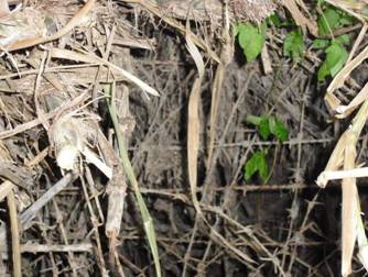
Figure
11.20 Vegetation Clearance to Gain Access to the
Trial Pits and Auger Holes |

Field Scan: It was
unable to perform the field scan due to the heavy vegetation in this
section. The overgrown vegetation is extremely
tall and dense. As a result, no archaeological interest
materials had been found.
Auger Hole Results: A total
of 14 auger holes (i.e. AH6 to AH19) were bored within this section. The locations of auger holes were distributed
as far from the existing river as possible along the river bank of the
|
|
|
Figure 11.21 Spiked Fence Blocked Further Access towards
South of AH19 |
All auger holes in Pak Fu Shan
Section (i.e. AH6 to AH19) are situated on Quaternary Holocene alluvium (marked
as “Qa” on Figure
11.17). Detailed auger hole
records are presented in Annex G3.
The auger hole data show that
the areas are generally covered with sandy layers. Deposits are well sorted and the grain size
generally increases further down the strata of auger holes, except for AH6 and AH19.
Strata with small to medium
gravels were found at 0.22m to over 1.23m below existing ground level. Gravels found in auger holes show medium to
high degree of rounding off, showing an intensive movement by water.
The excavation team stopped
drilling the auger holes further when hitting boulders. The depth of auger holes ranged from 0.4m to
1.5m.
Test Pit Results: A total
of 3 test pits (i.e. TP4 to TP6) were excavated manually in this section under
the supervision of the licensed archaeologist.
The stratigraphy of each test pit is described
below.
·
TP4: TP4
was allocated at the northern part of the field scan area in the Pak Fu Shan
section; situated on the superficial deposit of Quaternary Holocene alluvium
(marked as “Qa” in Figure 11.17);
at the eastern bank of Shenzhen River, southwest to a turn of the river;
northwest of an abandoned pig/chicken farm ([12]) as shown in Figure
11.16, outside a fence.
TP4
measured 1.5m x 1.5m in size, with a depth of 0.98m, and the ground level is
about 16.7 to 16.9mPD (see test pit record in Annex G2 and land survey record in Annex G4) and north-south
oriented.
Three
strata were identified according to their soil colour,
texture and inclusions. Details of the strata
and their interpretations are presented in Table
11.4 and Table 11.5, respectively.
Table 11.4 Strata of TP4
|
Strata |
Soil Colour |
Soil Texture |
Cultural Remains |
Minimum and Maximum Depth from Ground Level (m)# |
Thickness (m) |
|
1 |
Yellowish brown |
Loose
fine sand |
Packing
of drinks, food and shampoo |
0 |
0.20 - 0.48 |
|
2 |
Red |
Loose
coarse Sand with small rounded gravel |
Plastic,
shards of glazed porcelain tiles and glass |
0.20 - 0.48 |
0.10 - 0.22 |
|
3 |
Bluish gray |
Loose
coarse Sand with small to medium gravel |
Plastic |
0.55 - 0.78 |
≥ 0.20 |
Note: # Depth is measured from ground level to the surface of each stratum.
Table 11.5 Interpretation of Strata for TP4
|
Strata |
Interpretation |
|
Strata
1 to 3 |
Deposits
formed by flooding in recent decades. Modern
waste containers such as shampoo container were unearthed in Stratum 1. They were probably refuse from nearby
residents transported to the river bank.
These three strata are considered as different layers of deposit
formed from previous flooding along the SZR.
Therefore, all cultural remains are believed to be secondary deposit,
which were transported by flood water to the discovery location. |
·
TP5: TP5 was
allocated on the superficial deposit of Quaternary Holocene alluvium (marked as
“Qa” in Figure
11.17) on the
eastern bank of the
TP5 measured 1.5m x 1.5m, with
a depth of 1.2m, and the ground level is 16.6mPD (see test pit record in Annex G2 and land survey record in Annex G4) and north-south
oriented.
Five strata were identified according
to their soil colour, texture and inclusions. Details of the strata and their
interpretations are presented in Table 11.6 and Table 11.7,
respectively.
Table 11.6 Strata of TP5
|
Stratum |
Soil
Colour |
Soil
Texture |
Cultural
Remains |
Minimum and Maximum Depth from Ground Level
(m)# |
Thickness (m) |
|
1 |
Brown |
Loose fine sand |
None |
0 |
0.13 - 0.23 |
|
2 |
Brownish yellow |
Loose fine sand |
Wire of boundary fence |
0.13 – 0.23 |
0.28 - 0.40 |
|
3 |
Gray |
Loose medium to coarse sand
with small amount of small to medium gravels |
None |
0.48 – 0.56 |
0.10 - 0.28 |
|
4 |
Brownish yellow |
Loose medium to coarse sand
with small amount of small gravels |
None |
0.62 – 0.75 |
0.18 - 0.36 |
|
5 |
Gray |
Coarse sand with small to
medium gravels |
Pottery shard |
0.90 – 1.01 |
Cannot determine due to reach of ground water level |
|
Note: # Depth is measured from the ground level to the surface of each
stratum. |
|||||
Table 11.7 Interpretation of Strata for TP5
|
Strata |
Interpretation |
|
Stratum
1 |
Surface
soil covered by overgrown grass with well sorted fine sand, it is a typical
river bank deposit layer. |
|
Stratum
2 |
Wires
found in the deposit indicated that there was a fence on site. This stratum could be relatively dated
between the periods that the fence was still standing and the recent flooding
of Shenzhen River. |
|
Strata
3 to 4 |
Deposit
formed by flooding. |
|
Stratum
5 |
River
bank deposits, gravels found in this stratum showed a medium degree of
rounding off. Because of the slope situated at southeast of
the river, sediment gradually moved the Shenzhen River westward. Only one pottery shard was found in this stratum
and the shard was probably transported here by flood water. |
·
TP6: TP6
was allocated on the superficial deposit of Quaternary Holocene alluvium
(marked as “Qa” in Figure 11.17)
on the eastern bank of the Shenzhen River, west of a steep slope of Pak Fu
Shan; southwest of TP5.
TP6 measured 1.5m x 1.5m, with
a depth of 1.3m, and the ground level is 14.5mPD (see test pit record in Annex G2 and land survey record in Annex G4) and north-south
oriented.
Eight strata were identified
according to their soil colour, texture and
inclusions. Details of the strata and
their interpretations are presented in Table
11.8 and Table 11.9, respectively.
Table 11.8 Strata of TP6
|
Strata |
Soil Colour |
Soil Texture |
Cultural Remains |
Minimum and Maximum Depth from
Ground Level (m)# |
Thickness (m) |
|
1 |
Very Dark Gray |
Soft Clay |
None |
0 |
0.04 - 0.10 |
|
2 |
Yellow |
Loose Medium Sand |
None |
0.04 – 0.10 |
0.33 - 0.44 |
|
3 |
Gray |
Loose Medium Sand with small
amount of small gravels |
None |
0.36 – 0.42 |
0.11 - 0.20 |
|
4 |
Olive Yellow |
Compact Medium Sand |
None |
0.53 – 0.62 |
0 - 0.22 |
|
5 |
Light Gray |
Loose Coarse Sand |
None |
0.63 – 0.80 |
0 - 0.20 |
|
6a |
Light Gray |
Fine Sand |
Wood |
0.62 – 0.83 |
0.10 - 0.26 |
|
6b |
Gray |
Fine Sand |
Blue-and-white porcelain, dark reddish brown glazed porcelain, plastic |
0.90 – 0.96 |
0.21 - 0.30 |
|
7 |
Olive Yellow |
Coarse Sand |
None |
1.17 – 1.24 |
≥ 0.05 - 0.12 |
|
Note: # Depth is measured
from the ground level to the surface of each stratum. |
|||||
Table 11.9 Interpretation of Strata for TP6
|
Strata |
Interpretation |
|
Stratum
1 |
Surface
soil covered by overgrown grass with soft clay. |
|
Strata
2 to 5 |
Deposit
formed by recent flooding. |
|
Stratum
6a-6b |
A former
marsh area formed before the existing marsh.
Overgrown weed covered the former marsh; when the grass fell and
decomposed, a thick layer of fine sand containing organic materials was
formed. The former marsh had been eroded by flooding,
sand and cultural remains were transported here. Therefore, all cultural remains identified
are considered as secondary deposit, which were transported by floodwater. |
|
Stratum
7 |
Deposit
formed by previous flooding. |
Section 4 (i.e. Chuk Yuen Section)
Site Condition: The
field scan area in Chuk Yuen Section comprised mostly
active cultivation land and dense weeds along the existing Border Road.
Field Scan: The
field scan was conducted on accessible land within the field scan area. The area is actively used and has been
disturbed by local villagers and modern refuse were observed on site. No archaeological interest materials were
identified during field scan.
Auger Hole Results: A
total of 5 auger holes (AH1 to AH5) were bored in this section. The locations of the auger holes are shown in
Figure
11.18. All auger holes in Chuk
Yuen Section (i.e. AH1 to AH5) were situated on Quaternary Pleistocene terraced
alluvium (marked as “Qpa” on Figure 11.19). Detailed auger hole
records are listed in Annex G3.
The auger hole data show that
sandy layer are generally distributed within field scan area of this
section. Deposits were well sorted and
the grain size generally increases further down the strata of auger holes, except
for AH2.
Strata with medium gravels
were found at 0.32m to over 1.30m below ground level. Gravels found in auger holes show medium to
high degree of rounding off, showing an intensive movement by water current.
The excavation team stopped
drilling the auger holes further when hitting boulders or reached the end of
auger. The depth of auger holes ranged
from 1.5m to 2.15m.
Test Pit Results: A
total of 3 test pits (i.e. TP1 to TP3) were excavated manually in this section
under the supervision of the licensed archaeologist. The stratigraphy of
each test pit is described in following sections:
·
TP1: TP1
was located in northern central area of the field scan area in the Chuk Yuen section; situated on the superficial deposit of
Quaternary Pleistocene terraced alluvium (marked as “Qpa”
in Figure
11.19); eastern
bank of the Shenzhen River and at the northwest of the former Chuk Yuen village.
TP1
measured 1.2m x 1.2m in size, with a depth of 1.27m, and the ground level is
8.9mPD (see test pit records are presented in Annex G2 and land survey record is presented in Annex G4)
and north-south oriented. The excavation terminated at a depth of
1.27m from the ground and supplemented with auger drilling from the bottom
layer of TP1 down to 1.87m from the ground due to safety reason.
Eight
strata were identified according to their soil colour,
texture and inclusions. It should be
noted that stratum 8
and part of stratum 7
were identified by drilling auger hole in the middle of the test-pit. Details of the strata and their
interpretations are presented in Table 11.10 and Table
11.11, respectively.
Table 11.10 Strata of TP1
|
Strata |
Soil Colour |
Soil Texture |
Cultural Remains |
Minimum and Maximum Depth
from Ground Level (m)# |
Thickness (m) |
|
1 |
Brownish Yellow |
Compact Clay |
None |
0 |
0.20 - 0.38 |
|
2 |
Light Yellowish Brown |
Compact Sandy Clay |
None |
0.20 – 0.38 |
0.18 - 0.30 |
|
3 |
Light Gray and Yellow |
Compact Clayey Sand |
Blue-and –White Porcelain;
White Porcelain; Celadon; and Village Ware |
0.45 – 0.53 |
0.14 - 0.20 |
|
4 |
Yellow |
Compact Medium Sand |
White Porcelain; village
ware; and Carbonized Wood |
0.64 – 0.70 |
0.07 - 0.13 |
|
5 |
Olive Yellow |
Loose Clayey Sand |
None |
0.73 – 0.84 |
0.08 - 0.17 |
|
6 |
Yellowish Brown |
Loose Medium Sand |
None |
0.84 – 0.93 |
0.26 - 0.32 |
|
7+ |
Yellowish Brown |
Compact Medium Sand |
None |
1.17 – 1.26 |
0.60 |
|
8+ |
Yellowish Brown |
Coarse
Sand with Fine Pebbles |
None |
1.57 |
≥
0.3 |
|
Note: # Depth is measured from the ground
level to the surface of each stratum. + Part of Stratum 7 and Stratum 8 were identified by auger
hole drilling from the bottom level of the pit. |
|||||
Table 11.11 Interpretation of Strata for TP1
|
Strata |
Interpretation |
|
Strata
1 to 8 |
All
deposits show a well sorted characteristic and generally grain sizes increase
as it goes further down below ground level, which represents a typical river
formed alluvial deposit. Artefacts found in Strata 3 and 4 were secondary
deposits. The shards of ceramics
recovered show a high degree of fragmentation and rounding off by flood water. |
·
TP2: TP2
was allocated in southern central area of the field scan area in the Chuk Yuen section (see Figure
11.18); situated on the superficial deposit of Quaternary Pleistocene
terraced alluvium (marked as “Qpa” in Figure
11.19); eastern
bank of the Shenzhen River. It is
located at southwest of original Chuk Yuen village
and south of TP1.
TP2
measured 1.2m x 1.2m in size, with a depth of 1.2m, and the ground level is
8.7mPD (see test pit record presented in Annex G2 and land survey record presented in Annex G4) and north-south
oriented. The excavation terminated at a depth of 1.2m from the
ground and supplemented with auger drilling from test pit bottom layer down to
2.1m from the ground due to safety reason.
Seven
strata were identified according to their soil colour,
texture and inclusions. It should be
noted that stratum 5
and part of stratum 4
were identified by drilling an auger hole in the middle of the test-pit. Details of the strata and their
interpretations are presented in Table 11.12 and Table
11.13, respectively.
Table 11.12 Strata of TP2
|
Strata |
Soil Colour |
Soil Texture |
Cultural Remains |
Minimum and Maximum Depth
from Ground Level (m)# |
Thickness (m) |
|
1a |
Dark Yellowish Brown |
Clay |
None |
0 |
0.10 - 0.16 |
|
1b |
Dark Yellowish Brown |
Clay |
None |
0.10 – 0.16 |
0.04 - 0.14 |
|
2 |
Yellow Brown |
Sandy Clay |
None |
0.17 – 0.25 |
0.09 - 0.24 |
|
3a |
Brownish Yellow |
Clayey Sand |
None |
0.30 – 0.48 |
0.07 - 0.25 |
|
3b |
Light
Yellowish Brown |
Clayey
Sand |
None |
0.50 – 0.57 |
0.06 - 0.16 |
|
4+ |
Light
Yellowish Brown |
Clayey
Sand |
Blue-and-white
porcelain, white porcelain, dark brown and yellowish brown glazed porcelain |
0.60 – 0.69 |
1.31 - 1.40 |
|
5+ |
Yellowish
Brown |
Clayey
Sand |
None |
2.0 |
≥
0.10 |
|
Note: # Depth is measured from the ground
level to the surface of each stratum. + Part of Stratum 4 and Stratum 5 were identified by auger
hole drilling from the bottom level of the pit. |
|||||
Table 11.13 Interpretation of Strata for TP2
|
Strata |
Interpretation |
|
Strata
1 to 5 |
All
deposits show a well sorted characteristic and generally grain sizes increase
as it goes further down below ground level, which represents a typical river
formed alluvial deposit. Artefacts found in Stratum 4 were secondary
deposits. The shards of ceramics
recovered show a high degree of fragmentation and rounding off. |
·
TP3: TP3 is located at the southern area of the
field scan area in the Chuk Yuen section. It situates on the superficial deposit of
Quaternary Pleistocene terraced alluvium (marked as “Qpa”
in Figure
11.19); on an
active cultivation land; and at the eastern bank of the
TP3
measured 1.5m x 1.0m in size, with a depth of 1.30m, and the ground level is
8.6mPD (see test pit record presented in Annex G2 and land survey record presented in Annex G4)
and north-south oriented. After removal of topsoil, it was found that there was
a concrete path situated at the northern section of the test pit which
constrained TP3 to be excavated in normal rectangular/square shape. As a result, the test pit was excavated in
irregular shape. The excavation terminated at a depth of
1.3m from the ground and supplemented with auger drilling from test pit bottom
layer down to 2.05m from the ground due to safety reason.
Five
strata were identified according to their soil colour,
texture and inclusions. It should be
noted that part of stratum 5 was identified by drilling an auger hole in the
middle of the test-pit since it is unsafe to further excavate by hand without
extending the width of the test pit.
Details of the strata and their interpretations are presented in Table 11.14 and Table 11.15, respectively.
Table 11.14 Strata of TP3
|
Strata |
Soil Colour |
Soil Texture |
Cultural Remains |
Minimum and Maximum Depth
from Ground Level (m)# |
Thickness (m) |
|
1 |
Reddish Yellow |
Clay |
None |
0 |
0.15 - 0.23 |
|
2 |
Brownish Yellow |
Sandy Clay |
Blue-and-white
porcelain, white porcelain, celadon, tile, dark brown glazed porcelain, plain
porcelain, pottery, metal and plastic |
0.15 – 0.23 |
0.17 - 0.26 |
|
3 |
Olive Yellow |
Clayey Sand |
Blue-and-white
porcelain, celadon, tile, pottery, dark brown glazed porcelain and plain
porcelain |
0.36 – 0.49 |
0.18 - 0.60 |
|
4 |
Olive
Yellow |
Compact
Clayey Sand |
Blue-and-white
porcelain, celadon, tile, dark brown glazed porcelain and plain porcelain |
0.47 – 0.60 |
0.25 - 0.36 |
|
5+ |
Yellowish
Brown |
Loose
Clayey Sand |
None |
0.80 – 0.90 |
≥
1.15 |
|
Note: # Depth is measured from the ground
level to the surface of each stratum. + Part of Stratum 5 was identified by auger hole drilling from the bottom
level of the pit. |
|||||
Table 11.15 Interpretation of Strata for TP3
|
Strata |
Interpretation |
|
Strata
1 to 5 |
All
deposits show a well sorted characteristic and generally grain sizes increase
as it goes further down below ground level, which represents a typical river
formed alluvial deposit. The artefacts found in Stratum 2 to Stratum 4 were secondary
deposits. The shards of ceramics show
a high degree of fragmentation and rounding off. |
11.5.3
Finds
Assessments
No in situ artefacts were found at both Pak Fu Shan Section and Chuk Yuen Section.
Only a small quantity of secondary deposits (ceramics shards (pottery,
tile and porcelain), metal, woods (including carbonized wood) and plastics)
which were transported by river water to the site were unearthed from the test
pits. The shards unearthed are of small size and show a high degree of rounding off. The shards are too small to
identify their types. It is therefore not
possible to determine the relative dating based on the shards.
Section 2 (i.e. Pak Fu Shan Section)
In Pak Fu Shan section, 1
pottery shard, 4 porcelain shards, 2 pieces of wood and 3 pieces of
plastic shard were unearthed and collected; artefacts
unearthed from TP4 were not collected as part of the archive because they are
recent secondary deposit in nature. Their associated test-pit and strata information are
listed in Table 11.16:
Table 11.16 Artefacts Unearthed and Collected in Pak Fu Shan Section
|
TP
No. |
Stratum |
Type |
|||
|
|
|
Pottery |
Porcelain |
Wood |
Plastic |
|
TP5 |
5 |
1 |
|
|
|
|
TP6 |
6a |
|
|
2 |
|
|
|
6b |
|
4 |
|
3 |
|
Note: (a)
Unit of Quantity is pieces (pcs). |
|||||
Pottery: A
grey pottery shard (灰陶) (NPFS2010: SF 1) was
unearthed in Stratum 5 of TP5. This
shard has a grey clay body and is plain in appearance without any
decoration, paint and glaze. The shard
shows a high degree of rounding off which indicated that it had been
transported by flood to the site (see Figure 11.22).
|
|
|
|
Figure 11.22 Grey Pottery Shard (NPFS2010:
SF 1) (Left: Dorsal; Right: Ventral) |
|


Section 4 (i.e. Chuk Yuen Section)
In Chuk
Yuen section, 2 pottery shards, 27 tile shards, 1 metal lid, 138 porcelain shards,
2 plastic pieces and 1 carbonized wood piece were unearthed. There associated test-pit and strata information was listed in Table
11.17.
Table 11.17 Artefacts Unearthed in Chuk Yuen
Section
|
TP No. |
Stratum |
Type |
|||||
|
Pottery |
Tile |
Metal |
Porcelain |
Plastic |
CarbonizedWood |
||
|
TP1 |
3 |
|
|
|
14 |
|
|
|
|
4 |
|
|
|
2 |
|
1 |
|
TP2 |
4 |
|
|
|
24 |
|
|
|
TP3 |
2 |
1 |
1 |
1 |
30 |
2 |
|
|
|
3 |
1 |
8 |
|
41 |
|
|
|
|
4 |
|
18 |
|
27 |
|
|
|
Notes: (a)
Unit of Quantity
is pieces (pcs). (b)
Celadon is
categorized as porcelain. (c)
Porcelain
includes blue-and-white porcelain and village wares. |
|||||||
Pottery: A
pottery shard (NCY2010: SF 2) with incised decoration was unearthed in Stratum
2 of TP3 (see Figure 11.23). It is a body shard and is too small to
determine the shape of the original vessel.
Incisions of parallel lines and curved lines were made by sharp object and comb. Black pigment was applied on the surface of
the shard.
|
|
|
|
Figure 11.23 Pottery Shard (NCY2010: SF 2) Photograph
(Left) and Drawing (Right) |
|


A painted pottery (彩陶) shard (NCY2010: SF 1) was
unearthed in Stratum 3 of TP3 (see Figure 11.24). One side of
the shard was rounded. It could be a rim
shard of a vessel, but the shard is too small to identify the original
type. The shard has a reddish brown clay
body with black paint. Paint was applied
partly on the dorsal side and entirely on the ventral side. No other decoration was identified.
|
|
|
|
Figure 11.24 Painted Pottery Shard (NCY2010: SF 1) (Left: Dorsal; Right: Ventral) |
|


Porcelain: A rim shard (NCY2010: SF 3) unearthed in Stratum 4 of TP2 is illustrated in Figure
11.25. Both the exterior and
interior of this rim shard are glazed with dark brown glaze. The shape of the original vessel is
unknown. Other porcelain shards are
illustrated in Figure 11.26.
The majority of the ceramic
shards are brown/dark brown glazed porcelain shards. Those shards possibly came from the village wares used by local people living in the former Chuk Yuen Village.
|
|
|
|
|
Figure 11.25 Rim Shard (NCY2010: SF 3) Photograph (Upper) and Drawing (Lower) |


|
|
|
|
|
Figure 11.26 Selected Brown and
Dark Brown Glazed Porcelain Recovered from Stratum 4 of TP2 (Upper); Selected
Blue-and-white Porcelains, White Porcelain and Celadon Recovered from Stratum
4 of TP3 (Lower) |


11.6
Assessment of Cultural Heritage Impacts
11.6.1
Impact
on Archaeological Resources
The desktop review identified that Sections 1, 3 and 5
have no archaeological potential.
Therefore, no impact is expected in these three sections.
The desktop review and field survey identified that
the Pak Fu Shan and Chuk Yuen sections of the Project
Site have archaeological potential.
During this EIA Study, field survey was conducted and identified a small
quantity of fragmented artefacts (only 5 and 167
ceramic shards were found in Pak Fu Shan section and Chuk
Yuen section, respectively). However, none
of them are considered to be primary deposits or significant archaeological
deposits. Test pits and auger holes
result form both sections show that deposits are formed by flooding and
inclusions (e.g. gravels and artefact shards). The inclusions identified within the deposits
are having medium to high degree of rounding off, suggesting the inclusions
were carried by water for a long distance and deposited at the as-found
locations. As the deposits and their
inclusions are secondary deposits in nature, their archaeological potential is
considered very low. Artefact
shards found are small and cannot be refitted to
determine their original shape; very few archaeological data can be extracted
from these archaeological materials, their archaeological potential is thus
considered very low.
Therefore, the overall archaeological potentials in
Sections 2 and 4 are very low. Chance of
finding in situ archaeological
deposits is very low. The impact is
considered acceptable as the secondary deposits identified are considered to
have very low significance.
However, it should be noted that the archaeological
impact assessment focus on the potential impact area within the works boundary
as at the date of the report. If the
works boundary changes in later stage to cover additional area not covered in
the EIA, the need for further archaeological survey and subsequent impact
assessment should be reviewed and AMO should be consulted.
11.6.2
Impact
on Built Heritage
No built heritage features were identified within the Project Site and
hence no direct impact is anticipated.
Based on the distance between the Project Site and the location of the identified built heritage features, the
potential impact of the Project on these features have been evaluated and
presented in Table 11.18.
All the identified
built heritage features are situated far away from the Project
Site. With respect to the nature of the
construction activities (mainly earthworks and concreting works which will not cause
significant vibration) and hence potential indirect impacts are not
anticipated.
Table 11.18 Graded/Proposed Graded Historic
Buildings and Other Built Heritage Features Identified within the CHIA Study
Area
|
Features Code |
Figure No. |
Identified Historic Buildings and Features |
Approx. Distance from the Project Site |
Impact Assessment |
|
G201 |
11.4 |
MacIntosh Fort (Pak Fu Shan), Pak Fu Shan |
205m |
Due to the large separation distance, no impact is anticipated. |
|
G202 |
11.11 |
MacIntosh Fort (Ngau Yiu), Sha Tau Kok |
156m |
Due to the large separation distance, no impact is anticipated. |
|
G301 |
11.10 |
Ta Kwu Ling Police Station, Ping Che |
60m |
Due to the large separation distance, no impact is anticipated. |
|
G302 |
11.5 |
Nos. 57-59 Tsung Yuen Ha |
212m |
Due to the large separation distance, no impact is anticipated. |
|
GN01 |
11.5 |
No. 61-62 Tsung Yuen Ha |
238m |
Due to the large separation
distance, no impact is anticipated. |
|
G303 |
11.5 |
Kiu Fong Ancestral Hall |
232m |
Due to the large separation
distance, no impact is anticipated. |
|
BS01 |
11.5 |
Ho Ancestral Hall, No. 1 Tsung Yuen Ha |
202m |
Due to the large separation distance, no impact is
anticipated. |
|
BS02 |
11.5 |
Nos 48 to 50 Tsung Yuen Ha |
176m |
Due to the large separation distance, no impact is
anticipated. |
|
BS03 |
11.5 |
East of Ho Ancestral Hall, Tsung Yuen Ha |
185m |
Due to the large separation distance, no impact is
anticipated. |
|
BS04 |
11.5 |
House between Nos 7 and 9, Tsung
Yuen Ha |
216m |
Due to the large separation distance, no impact is
anticipated. |
|
BS05 |
11.5 |
Nos 34 to 38 Tsung Yuen Ha |
227m |
Due to the large separation distance, no impact is
anticipated. |
|
BS06 |
11.5 |
No. 56B Tsung Yuen Ha |
202m |
Due to the large separation distance, no impact is
anticipated. |
|
BS07 |
11.5 |
No. 43 Tsung Yuen Ha |
227m |
Due to the large separation distance, no impact is
anticipated. |
|
BS08 |
11.5 |
No. 40 Tsung Yuen Ha |
231m |
Due to the large separation distance, no impact is
anticipated. |
|
BS09 |
11.5 |
Nos. 21 and 22 Tsung Yuen Ha |
218m |
Due to the large separation distance, no impact is
anticipated. |
|
BS10 |
11.5 |
Ruins at Nos. 27-29 Tsung Yuen Ha |
235m |
Due to the large separation distance, no impact is
anticipated. |
|
BS11 |
11.10 |
Fuk Tak Temple |
231m |
Due to the large separation distance, no impact is
anticipated. |
|
BS12 |
11.10 |
Nos. 27 and 27B Kan Tau Wai |
218m |
Due to the large separation distance, no impact is
anticipated. |
|
BS13 |
11.10 |
No 14 Kan Tau Wai |
231m |
Due to the large separation distance, no impact is
anticipated. |
|
BS14 |
11.10 |
Nos. 1 and 2 Kan Tau Wai |
239m |
Due to the large separation distance, no impact is
anticipated. |
|
BS15 |
11.10 |
No. 4A Kan Tau Wai |
235m |
Due to the large separation distance, no impact is
anticipated. |
|
BS16 |
11.10 |
Nos. 27A, 30A and 30B Kan Tau Wai |
294m |
Due to the large separation distance, no impact is
anticipated. |
|
GR01 |
11.3 |
Man Clan Grave |
200m |
Due to the large separation distance, no impact is
anticipated. |
|
GR02 |
11.5 |
Graveyard |
286m |
Due to the large separation distance, no impact is anticipated. |
|
GR03 |
11.6 |
Group of Law Clan Graves (4 Nos.) |
152m |
Due to the large separation distance, no impact is
anticipated. |
|
GR04 |
11.6 |
Group of Tang Clan Graves (3 Nos.) |
144m |
Due to the large separation distance, no impact is anticipated. |
|
GR05 |
11.9 |
Ng Grave |
134m |
Due to the large separation distance, no impact is
anticipated. |
|
GR06 |
11.8 |
Fu Grave |
202m |
Due to the large separation distance, no impact is
anticipated. |
|
GR07 |
11.7 |
Yiu Grave |
73m |
Due to the large separation distance, no impact is
anticipated. |
|
LF01 |
11.5 |
Cannon, Tsung Yuen Ha |
177m |
Due to the large separation distance, no impact is
anticipated. |
|
LF02 |
11.5 |
Well, Tsung Yuen Ha |
174m |
Due to the large separation distance, no impact is
anticipated. |
|
LF03 |
11.5 |
Shrine, Tsung Yuen Ha |
241m |
Due to the large separation distance, no impact is
anticipated. |
|
LF04 |
11.10 |
Shrine, Kan Tau Wai |
208m |
Due to the large separation distance, no impact is
anticipated. |
Three other projects are identified to be
implemented concurrently with the Project and some of the works areas
of these projects overlap with that of this Project. The concurrent
projects include:
·
Liantang/Heung Yuen Wai Boundary Crossing Point (BCP) and Associated Works
(LT/HYW BCP);
·
Construction of a Secondary Boundary Fence and
New Sections of Primary Boundary Fence and Boundary Patrol Road (SBF Project); and
·
Drainage Improvement in Northern New
Territories – Package C
(Remaining Works) (Drainage Improvement Project).
Although the western edge of the proposed works
area of the LT/HYW BCP and the Chuk Yuen and Pak Fu
Shan sections of the works area of SBF Project overlap with this Project, no
cultural heritage resources are identified within the overlapped areas. Thus, no cumulative impacts are anticipated.
The project area of the Drainage Improvement
Project is located outside the CHIA Study Area and the works area of this
Project. Therefore, no cumulative
impacts are anticipated.
11.8.1
Archaeology
Impact assessment indicates
that Sections 1, 3 and 5 have no archaeological potential, thus no impact is
expected. Therefore, no mitigation
measure is required in Sections 1, 3 and 5.
For Sections 2 and 4,
their archaeological potential is considered very low.
Chance of finding in-situ archaeological deposits is also very low. The impact is considered acceptable as the
secondary deposits identified are considered to have very low
significance. However, the chance of
discovery of very low significance secondary deposits cannot be ruled
out. Pursuant to the Antiquities and Monuments Ordinance, the
project proponent should inform the AMO immediately in case of discovery of
antiquities or supposed antiquities in the course of soil excavation works in
construction stage.
However, it should be noted that the archaeological
impact assessment covered only the works area assigned as at the date of this
report. If the works boundary changes in
later stage to cover additional area not covered in the EIA, the need for
further archaeological survey and subsequent impact assessment should be
reviewed and AMO should be consulted.
11.8.2
Built
Heritage
As presented in Table 11.18, no direct or
indirect impacts on the identified built heritage sites are anticipated due to their
large separation distance from the Project Site, no mitigation measures are
considered necessary.
Since no impacts
on identified built heritage and in
situ archaeological resources are identified, no mitigation measures are required and thus there will be no
residual impact.
11.10
Environmental Monitoring and Audit
11.10.1
Archaeology
As impact assessment indicates
that the potential to identify in situ
archaeological deposits is very low, no archaeological monitoring is
required. However, the project proponent
should inform AMO immediately in case of discovery of antiquities or supposed
antiquities in the course of excavation works in construction stage.
In case the works boundary of the Project changes
during the detailed design stage to cover additional area not being assessed,
the need for further archaeological survey and subsequent impact assessment
should be reviewed and AMO should be consulted.
11.10.2
Built
Heritage
As no impacts on built heritage
are identified, no cultural heritage monitoring and audit is required.
Literature review and field
surveys identified no Declared Monument and government historic sites within
the CHIA Study Area of this Project. Five graded historic buildings, one nil grade
historic building, sixteen built structures, seven graves and four
cultural/historical landscape features are identified within the CHIA Study
Area and a small quantity of fragmented secondary archaeological deposits were
identified from archaeological survey at Chuk Yuen
and Pak Fu Shan sections (Sections 2 and 4) of the Project. Other sections (i.e. Sections 1, 3 and 5)
have been identified with no archaeological potential where no impact is
anticipated. In case the works boundary of
the Project changes during the detailed design stage to cover additional area
not being assessed, the need for further archaeological survey and subsequent
impact assessment should be reviewed and AMO should be consulted.
None of the identified built
heritage features will be directly or indirectly impacted by the proposed
development as they are located far from the Project Site. No mitigation measure or monitoring will be
required during the construction and operation phases of the Project.
The archaeological survey
identified only the secondary archaeological deposits at Chuk
Yuen and Pak Fu Shan sections of
the Project. The chance of finding in situ archaeological deposits is very
low. Therefore, no impact on significant
archaeological resources is anticipated and no archaeological monitoring is
required. Pursuant to the Antiquities and Monuments Ordinance, the project proponent should
inform the AMO immediately in case of discovery of antiquities or supposed
antiquities in the course of soil excavation works in construction stage.